

Showing posts with label Best Popular Posts. Show all posts
Showing posts with label Best Popular Posts. Show all posts
SOUTH AMERICAN LAUNCHED A NEW COLOR OCEAN MISSION BY SATELLITE
HUBBLE TELESCOPE FOUND A NEW MOON SATELLITE ON NEPTUNE BY ASTRONOMER MARK SHOWALTER

NASA Hubble telescope found a new moon on Neptune by Astronomer Mark Showalter. The new moon name is S/2004 N1. New moon is orbiting between Larissa and Proteus. It orbits Neptune's in 23 hours.
The new moon is a 14th moon orbiting to the planet. NASA announced officially on Monday. New moon estimated to be 20km in diameter, the moon distance from Neptune is 65,400 miles(1,05,251 kilometers). Astronomer Mark Showalter was researching in SETI institute in mountain view, Calitornia and he was searching on Hubble telescope images and Neptune's ring fragment circles.
Already Neptune's had many moons. Neptune's had largest moon. Largest moon name was Triton. Triton was discovered in 1846 and Neptune's second largest moon was Proteus. It was found by NASA's Voyager2 spacecraft and It found another five small moons, They are Naiad, Thalassa, Despina, Galatea and Larissa.
Neptune's third largest moon was Nereid. It was found in 1949.
TINY NEW SATELLITE PRODUCES A NATURAL GREEN MAP

A natural global map produces by a Tiny satellite. Tiny satellites is also called as Cubesat. This tiny satellite is looking like size of one washing machine and it was launched two months ago. This satellite is PROBA series of small satellites and satellite name was PROBA-V. Tiny satellite build by Belgian in the European Space Agency's.
The main purpose of the satellite is monitoring duties of the world. PROBA-V is a 15 years life time mission. PROBA-V will turn around to the Earth 14 times per a day and PROBA-V satellite is covering and capture globe every two days with 100-meter resolution camera.
Every 10 days , it will gives and produce a new 2,00,000megapixel image of the world. After 10 years, we will collect amazing images from tiny satellite. By tiny satellites, we will easy to observe, how earth weather and changing the world. ESA will built another a new Earth observing satellites. They are SENTINEL series of the satellites. The SENTINEL-3 should launch in next year.
NASA ENGINEERS GREAT SUCCEED ON NANO TECHNOLOGY

NASA Engineers great succeed on nano technology in satellites. Nano technology makes less size for Spacecraft instruments and NASA engineers are develop super-black nano technology with carbon nano tubes. They are develop spacecraft instruments and the instruments are more sensitive without enlarging the original size. super-black nanotubes is created by team of Jhon Haigopian.
[Read More...>>]
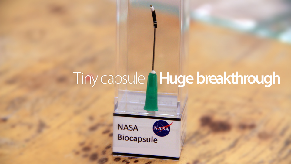
NASA Engineers great succeed on nano technology in satellites. Nano technology makes less size for Spacecraft instruments and NASA engineers are develop super-black nano technology with carbon nano tubes. They are develop spacecraft instruments and the instruments are more sensitive without enlarging the original size. super-black nanotubes is created by team of Jhon Haigopian.
[Read More...>>]
Labels:
Best Popular Posts,
Home
.
DEEP BLUE ALIEN PLANET FOUND HUBBLE SPACE TELECOPE

The NASA Scientists founded a new planet by Hubble space telescope. The planet name is HD18933b. It is appears in blue color. First time scientists have seen visible color planet. It takes 52.8 earth hours for the planet to travel fully around its sun. The HD18933b is a hot jupiter, Present temperature and atmosphere on HD 18933b is 1000 degrees Celsius.
[Read Full Story....]

The NASA Scientists founded a new planet by Hubble space telescope. The planet name is HD18933b. It is appears in blue color. First time scientists have seen visible color planet. It takes 52.8 earth hours for the planet to travel fully around its sun. The HD18933b is a hot jupiter, Present temperature and atmosphere on HD 18933b is 1000 degrees Celsius.
[Read Full Story....]
Labels:
Best Popular Posts,
Home
High thunderstorm Chantal in Atlantic Ocean

The Aqua satellites captured high thunderstorms chantal in Atlantic Ocean.This tropical storm is heavy falling rain. TRMM satellite measuring the rainfall rate, it is more than 115mm per hour at chantal middle point On July 8. Chintal thunderstorm is moving through to the Carribbean sea.


IRNSS-1A SUCCESSFULLY LAUNCHED INTO THE SPACE
 The Indian Space Research Organization(ISRO) successfully launched The IRNSS-1A satellite into the space from satish dhawan space centre at Sriharikota, Andrapradhesh at 11:41PM on July 1 2013.The satellite total weight 1,425kg. The Indian Polar Satellite Vehicle height is 44 meters,Orbit with apogee about 20,600km and perigee about 280km
Read more......>>
The Mars Atmosphere and Volatile Evolution

Labels:
Best Popular Posts
PSLV Vehicles

PSLV means Polar Sateliite Launch Vehicles.It is first operational and introduced launch vehicle of ISRO. The PLSV is launching 1600kg satellites into Sun-synchronous orbit.The Sun-synchronous orbit is above 620km from Earth surface and it is launching 1050kg satellites into Geo-synchronous orbit. PLSV contains standard features and configurations.It measures 44.4 m tall, with
a lift off weight of 295 tonnes.
PSLV has four stages using
solid and liquid propulsion
systems alternately. The first
stage is one of the largest
solid propellant boosters
in the world and carries 139
tonnes of propellant. A cluster
of six strap-ons attached
to the first stage motor,
four of which are ignited
on the ground and two are
air-lit.
The reliability rate of PSLV has
been superb. There had been 21 continuously successful flights of PSLV, till
September 2012 . With its variant configurations, PSLV has proved its multi-payload,
multi-mission capability in a single launch and its geosynchronous launch
capability. In the Chandrayaan-mission, another variant of PSLV with an
extended version of strap-on motors, PSOM-XL, the payload haul was enhanced to
1750 kg in 620 km SSPO. PSLV has rightfully earned the status of workhorse
launch vehicle of ISRO.
Till now, The launched PLSV vehicles are PLSV-D1,PLSV-D2, PLSV-D3, PLSV-C1, PLSV-C2,PLSV-C3, PLSV-C4, PLSV-C5, PLSV-C6, PLSV-C7, PLSV-C8, PLSV-C9, PLSV-C10,PLSV-C11, PLSV-C12, PLSV-C14, PLSV-C15, PLSV-C16, PLSV-C17, PLSV-C18, PLSV-C19, PLSV-C21.
Labels:
Best Popular Posts
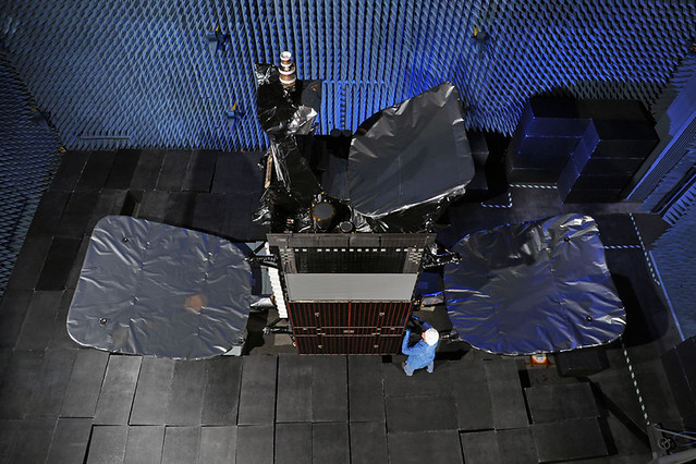
Successfully Intelsat-23 launched into Space

Labels:
Best Popular Posts
China launched two satellites into space for Global Positioning system
China launched two satellites into the space for Global positioning system and Global navigation network.These two satellites launched from Xichang Satellite Launch Center in southwest Sichuan province. by a Long March-3B carrier rocket.
these two satellites contains Beidou systems and this system used in transportation,weather forecasting,forestry,marine fisheries,hydrological monitoring and telecommunications,mapping.China started to build up its own satellite navigation system to break its dependence on the US GPS in 2000.It had a set up a regional satellite navigation system after launching three Beidou geostationary satellites.


.
Labels:
Best Popular Posts
Small Satellites


ISRO launched small satellites in space for useful and experimental purpose.This experiment satellites for Remote sensing ,Atmospheric Studies, Orbit Controls, Payload Development, Recovery Technology, Infrared Earth Changes etc.
JUGNU: jugnu is a nanosatellite.this net weight 3 kg.it is designed and developed by Indian Institute of Technology in Kanpur under the guidance of ISRO.The main purpose of this satellite is developed camera system for imaging the earth in the near infrared region and test image processing.It is evaluate GPS receiver and it is used in satellite navigation.
Subscribe to:
Posts (Atom)